
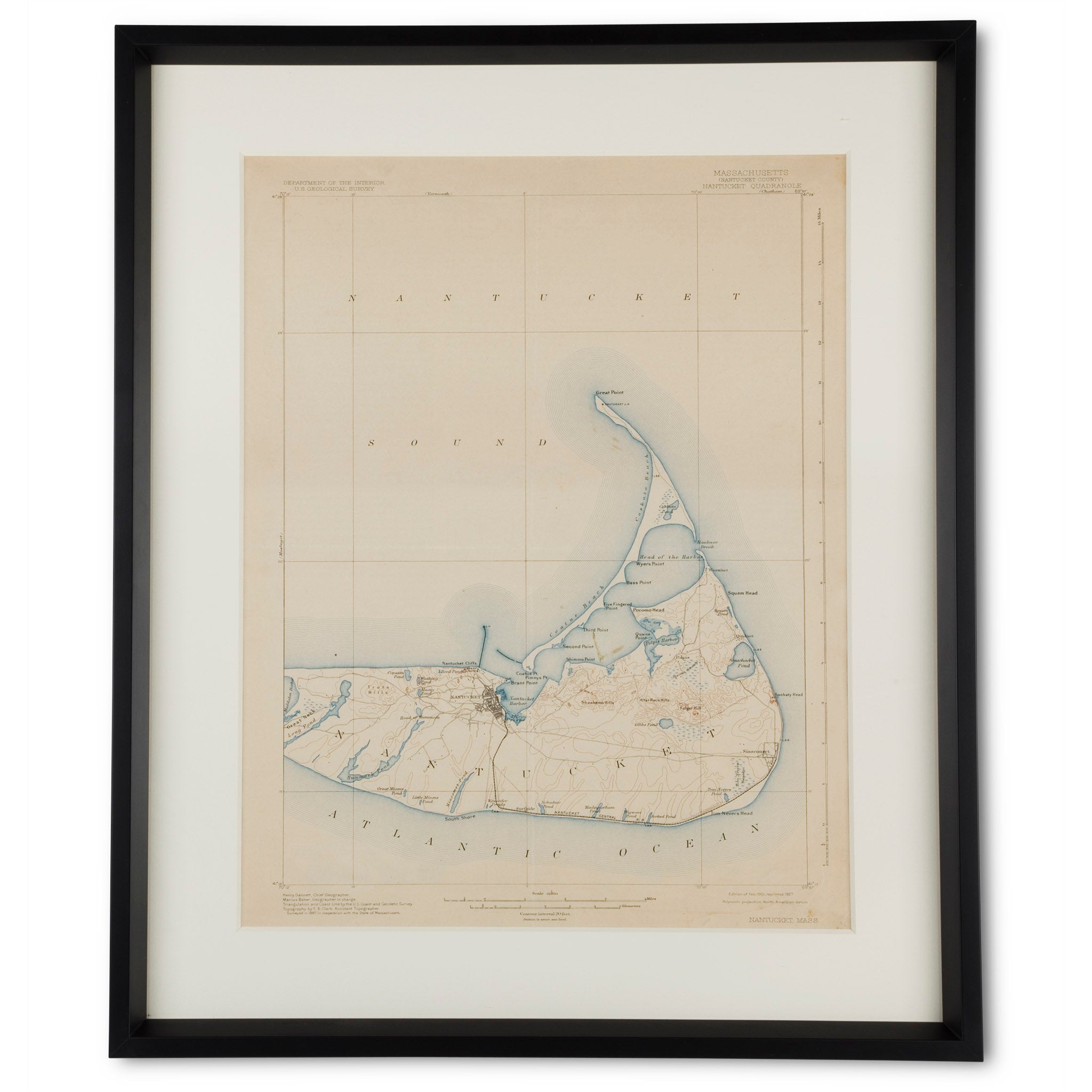
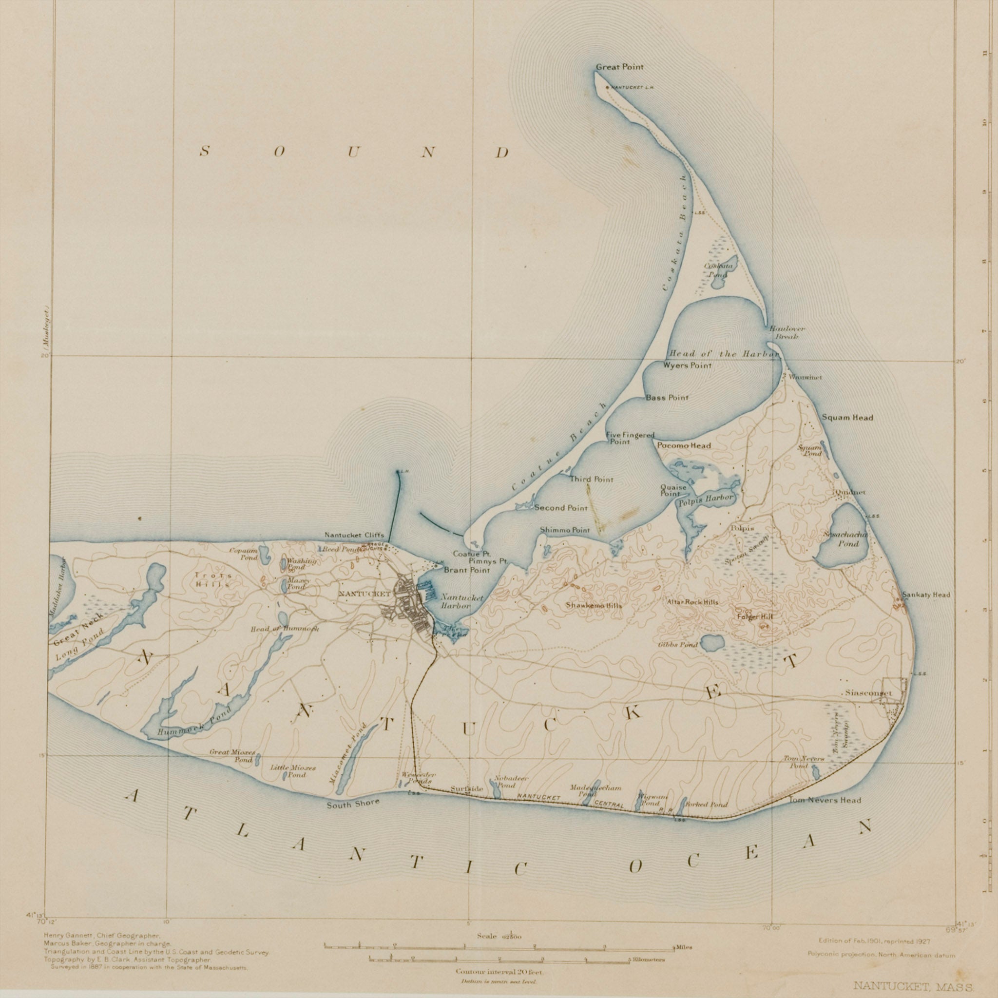
Vintage Nantucket Island Map
An original vintage nautical chart Nantucket Island circa 1920s. Produced for the Department of the Interior Geological survey showing Nantucket County of Massachusetts. Archival mounted, UV plexiglass, elegant black wooden frame. Excellent condition.
- Vintage Nantucket survey map
- Circa first quarter 20th Century
- Nautical chart with topography
- Ultra Violet filtering plexiglass
- Black wooden frame
- Acid free backing
- Hanging wire included
- Size: 25-1/2 H. x 20-1/2" W. (framed)
Shipping & Returns
We offer complimentary shipping on all US orders over $250 and a 14 day return policy on our products. We Ship Worldwide via FedEx.
Choose options
Vintage Nantucket Island Map
Sale price$1,695.00